Unlock a world of possibilities! Login now and discover the exclusive benefits awaiting you.
- Qlik Community
- :
- All Forums
- :
- QlikView App Dev
- :
- Re: How to implement google map in Qlikview?
- Subscribe to RSS Feed
- Mark Topic as New
- Mark Topic as Read
- Float this Topic for Current User
- Bookmark
- Subscribe
- Mute
- Printer Friendly Page
- Mark as New
- Bookmark
- Subscribe
- Mute
- Subscribe to RSS Feed
- Permalink
- Report Inappropriate Content
How to implement google map in Qlikview?
Hi,
Please give me step by step instruction to implement Google map in Qlik View.
Thanks,
Sandip Ghosh
- « Previous Replies
-
- 1
- 2
- Next Replies »
- Mark as New
- Bookmark
- Subscribe
- Mute
- Subscribe to RSS Feed
- Permalink
- Report Inappropriate Content
Hi
please find the below document if it is helpful to you then give the correct answer
Regards
prabhas
- Mark as New
- Bookmark
- Subscribe
- Mute
- Subscribe to RSS Feed
- Permalink
- Report Inappropriate Content
Where is the document?
Thanks,
Sandip
- Mark as New
- Bookmark
- Subscribe
- Mute
- Subscribe to RSS Feed
- Permalink
- Report Inappropriate Content
Hi,
Is I have to get google map Key from here?
http://code.google.com/apis/maps/signup.html
Actually when I go to this page the attached page is showing.
So please help me for getting a key
Sanndip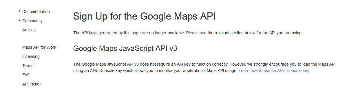
- Mark as New
- Bookmark
- Subscribe
- Mute
- Subscribe to RSS Feed
- Permalink
- Report Inappropriate Content
That's one helpful post taliking about geolocalization in QlikView:
- Mark as New
- Bookmark
- Subscribe
- Mute
- Subscribe to RSS Feed
- Permalink
- Report Inappropriate Content
Hi sandip
please refer below URL for the Goolge map API It will provide you the step by step details
https://community.qlik.com/docs/DOC-5709
Thanks
- Mark as New
- Bookmark
- Subscribe
- Mute
- Subscribe to RSS Feed
- Permalink
- Report Inappropriate Content
You plot points onto the maps using the long and lat, like you would use x & y in a graph.
The trick is getting the correct image which lines up with your long and lats, which is where the Google maps API's come in.
- Mark as New
- Bookmark
- Subscribe
- Mute
- Subscribe to RSS Feed
- Permalink
- Report Inappropriate Content
PFA,Go with this.
- Mark as New
- Bookmark
- Subscribe
- Mute
- Subscribe to RSS Feed
- Permalink
- Report Inappropriate Content
Hi,
I have implemented a Google map using scatter chart and based on city name I have displayed the chart. So city Name is my dimension and longitude and latitude are my expressions.
But when I choose a city in map the city location does not shoed up and city name is not point out by a marker.
Below is the screen shot and here in the image no city name is shown and instead of showing city name only road name or some building name is showing.
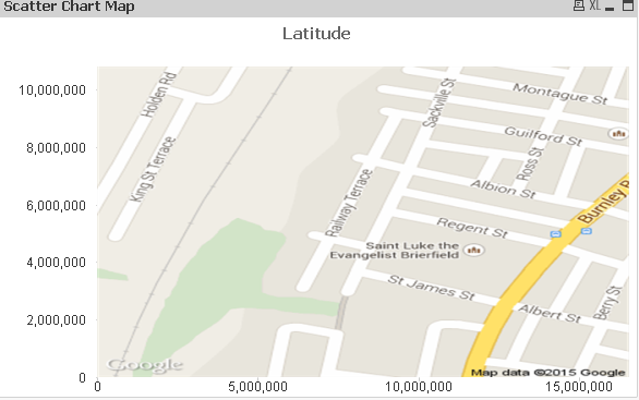
But I want the map just like below screenshot:
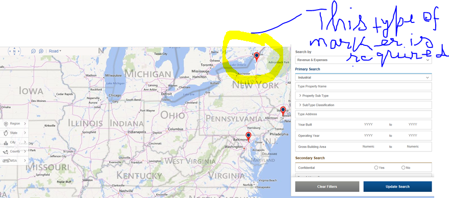
Thanks,
Sandip
- Mark as New
- Bookmark
- Subscribe
- Mute
- Subscribe to RSS Feed
- Permalink
- Report Inappropriate Content
can u try,
1. Hide axes from axis tab.
2.Check, labels on data point from presentation tab.
3. u will get some symbols,but if u need u have to go with geo maps.
- « Previous Replies
-
- 1
- 2
- Next Replies »